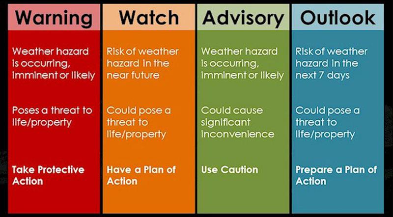
A SEVERE WEATHER ADVISORY HAS BEEN ISSUED FOR SAINT LUCIA FROM MIDNIGHT TO WEDNESDAY EVENING.
 At 11 a.m. today the center of Potential Tropical Cyclone Two was centered near latitude 9.8 North, longitude 57.5 West or 260 miles or 420 km east of Trinidad. The system is moving toward the west near 23 mph (37 km/h). A westward or west-northwestward motion is expected through Thursday. On the forecast track, the system will pass near or over portions of the southern Windward Islands by tonight.
A severe weather advisory has been issued for Saint Lucia from midnight to Wednesday evening. This system is expected to produce rainfall amounts of 1 to 3 inches or 25 to 75 millimetres across Saint Lucia. Interests in the Windward Islands should continue to monitor the progress of this system.
Two tropical waves located over the central Atlantic are forecast to interact with each other during the next few days as they move westward near 15 mph or 24 km/h. Gradual development of this system is possible and it is expected to affect the Lesser Antilles over the weekend.
Over the central Windward Islands and areas further south, cloudy to overcast at times with gusty winds, periods of rain, scattered moderate to heavy showers and thunderstorms. Elsewhere partly cloudy skies with a few showers.
Small craft operators and sea bathers are advised to exercise EXTREME caution due to gusty winds and rough seas.